ABOUT
CATCH Overview
The Comet-Asteroid Telescopic Catalog Hub (CATCH) is a search tool for large astronomical data sets. It was especially designed to find observations of moving targets, i.e., comets and asteroids. Use CATCH to help identify pre-discovery observations of a target, to examine past cometary activity, or to help you understand why a survey did not detect or report observations of an object.
CATCH solves the needle in the haystack problem: your favorite comets and asteroids are the needles, and the archives of survey data are the haystacks.
Provide the name of an asteroid or comet, and CATCH will:
- Request an ephemeris for that object from NASA JPL's Horizons System.
- Query the CATCH database for data near the ephemeris.
- Test each approximate match for detailed intersection with the ephemeris.
- Return all results with both target and observational metadata.
CATCH can also search for any fixed point on the sky, and up to 2 degrees in radius about it. Three areal search options are available. Find observations: (1) that intersect any part of the search area; (2) that are fully contained within the search area; or, (3) that fully contain the search area.
Capabilities
- Results are presented in the browser, complete with image cutouts around the query target.
- Backed by a publicly accessible API.
- Searches all near-Earth object survey data archived with NASA's Planetary Data System, and a few other survey data sets. Potentially any publicly hosted data archive could be included.
- Search results are cached and may be quickly retrieved thereafter, or refreshed with a new query.
- Queries may optionally search an area around the ephemeris: either an arbitrary radius, or using the ephemeris uncertainty ellipse (when available).
- CATCH is designed to have arcsecond-level precision, but searches will be limited by the astrometric accuracy of survey metadata.
Figures and Videos
A video summary of CATCH's techniques, CATCHing Near-Earth Objects in Archival Survey Data, given by M. Kelley, D. Darg, and J. Bauer to the 7th IAA Planetary Defense Conference (2021 Apr 27).
A video that focuses on the indexing techniques used in CATCH.
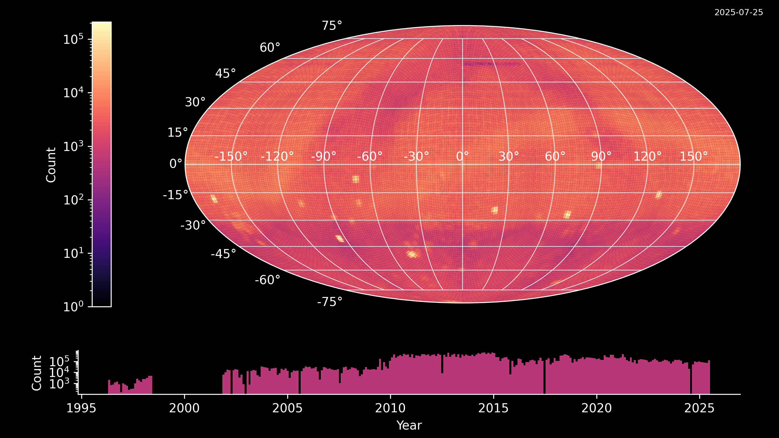
Data sources
| Survey | Site | Dates (UTC) | Nights | Images | Pixel scale (arcsec) | Field of view a (deg2) | Filters | Limiting magnitude | Archived at | References |
|---|---|---|---|---|---|---|---|---|---|---|
| Asteroid Terrestrial-impact Last Alert System (ATLAS) | Haleakala Observatory, Hawaii, USA (T05) | December 2018 – March 2024, ~July 2025c | 1,495c | 1,076,906c | 1.86 | 28 | o, c | PDS SBN | Denneau et al. 2024 | |
| Asteroid Terrestrial-impact Last Alert System (ATLAS) | Mauna Loa Observatory, Hawaii, USA (T08) | December 2018 – March 2024, ~July 2025c | 1,367c | 1,043,037c | 1.86 | 28 | o, c | PDS SBN | Denneau et al. 2024 | |
| Asteroid Terrestrial-impact Last Alert System (ATLAS) | El Sauce Observatory, Rio Hurtado, Chile (W68) | January 2022 – March 2024, ~July 2025c | 736c | 544,460c | 1.86 | 28 | o, c | PDS SBN | Denneau et al. 2024 | |
| Asteroid Terrestrial-impact Last Alert System (ATLAS) | South African Astronomical Observatory, Sutherland Station, South Africa (M22) | December 2021 – March 2024, ~July 2025c | 648c | 394,914c | 1.86 | 28 | o, c | PDS SBN | Denneau et al. 2024 | |
| Catalina Sky Survey | Mt. Bigelow, Arizona, USA (703, V06) | January 2020 – June 2025c | 1,251c | 1,408,208c | 2.5 or 3.0 (703), 0.6 (V06) | 8.1 or 19.4 (703), 0.03 (V06) | None | PDS SBN | Seaman et al. 2022 | |
| Catalina Sky Survey | Mt. Lemmon, Arizona, USA (G96, I52) | January 2020 – June 2025c | 1,295c | 1,704,048c | 1.0 or 1.5 (G96), 1.0 (I51) | 1.2 or 5.0 (G96), 0.3 (I52) | None | PDS SBN | Seaman et al. 2022 | |
| Lowell Observatory Near-Earth-Object Search (LONEOS) | Lowell Observatory, Anderson Mesa, Arizona, USA (699) | August 2003 – March 2008 | 522 | 290,593 | 2.53 | 4.1 | None | V~18–19 | PDS SBN | Tedesco and Davis 2024 |
| Near Earth Asteroid Tracking (NEAT) GEODSS | Haleakala Observatory, Hawaii, USA (566) | April 1996 – May 1998 | 147 | 36,099 | 1.43 | 2.7 | None | V~19 | PDS SBN | Bauer and Lawrence 2013, Pravdo et al. 1999 |
| Near Earth Asteroid Tracking (NEAT) Palomar Tri-Cam | Palomar Observatory, California, USA (644) | November 2001 – March 2003 | 150 | 128,164 | 1.01 | 1.3 | None | V~20 | PDS SBN | Bauer and Lawrence 2013, Tricarico 2016 |
| Pan-STARRS 1 (DR2) | Haleakala Observatory, Hawaii, USA (F51) | June 2009 – February 2015 | 1,438 | 17,558,049b | 0.25b | 24×24b | grizy | r~21.8 | STScI | Pan-STARRS1 data archive, Chambers et al. 2016, Waters et al. 2020, Magnier et al. 2020 |
| SkyMapper Southern Survey (DR4) | Siding Spring Observatory, New South Wales, Australia (413) | March 2014 – September 2021 | 1,757 | 12,630,515 | 0.5 | 0.16 | uvgriz | shallow survey~19, main survey~20–22 | Australian National University | Wolf et al. 2018, Onken et al. 2019 |
| Spacewatch 0.9-m Mosaic Camera Survey (v3) | Steward Observatory, Kitt Peak, Tohono O'odham Nation (691) | March 2003 – December 2016 | 2,256 | 1,808,188 | 1.0 | 0.35 | Schott OG-515 | V~21.7 | PDS SBN | Brucker et al. 2022 |
| aField of view of a single data product. | ||||||||||
| bThe Pan-STARRS 1 search is based on the archived "skycell" images. | ||||||||||
| cThese archives are accumulating data with time. Archive statistics were updated on 2025 July 29. Current statistics for CATCH holdings are available via the CATCH API. | ||||||||||
CATCH Limitations and Caveats
CATCH does not perform detection-based searches. i.e., it cannot determine if an object was observed. Rather, it identifies images that could have observed a target, based on the target's ephemeris. This search also requires that the ephemeris correctly describes the target's motion on the sky, and that a potentially matching observation is correctly described by its metadata.
Known issues
- NEAT and LONEOS astrometric solutions are typically up to ~5 arcmin off.
- NEAT Palomar/Tricam data from the night of 2002 June 17 have a row-order bug (C. Nugent, Olin College). These data are expected to be corrected in a future archive update.
- Target name resolution: our name resolution service is incomplete. Some real target names may not be resolved. However, CATCH can still attempt to search for them. Ultimately, any target must be resolvable by Horizons. Use JPL's Small-Body Database Lookup to test object names that are not working. Take care when searching for fragmented comets (e.g., 73P vs. 73P-C).
- Searches only include dates when an object is brighter than V=25 mag, as predicted by the ephemeris generator. Contact us if this limit is affecting your work.
- Images may not be correctly displayed in the image preview, which causes a misalignment with the PanSTARRS catalog overlay.
Updates
- v3.0 (2025 Jul 9):
- All preview images are now aligned with equatorial north up and east to the left, according to each image's world coordinate system.
- Improved the PanSTARRS DR2 catalog overlay to use metadata embedded in the JPEG cutouts, if available.
- v3.0-beta (2025 Jan 31):
- New features:
- Solar System viewer showing the orientation of the Sun, Earth, target, and other objects at the time of each observation.
- Image cutout services for all PDS-hosted data.
- Added Lowell Observatory Near-Earth Objects Survey (LONEOS) data collection.
- Added Asteroid Terrestrial-impact Last Alert System (ATLAS) data collections. The ATLAS collections will be continuously updated with new and previously obtained data.
- Fixed-target (celestial) searches.
- Date-range searches.
- PanSTARRS DR2 catalog overlay in the image preview area.
- Other updates:
- Improved web app responsiveness for results with a large number of observations.
- Updated Spacewatch 0.9m Mosaic Camera Survey data from v1.0 to v3.0.
- Updated SkyMapper Southern Sky Survey Data Release from 2 to 4.
- Updated the size of NEAT cutouts to accommodate images with large astrometric errors.
- v2.0 (2023 Mar 15):
- New features:
- A new search technique enables areal searches (padding or uncertainty ellipse).
- Search by source now allowed.
- Added Spacewatch 0.9m Mosaic Camera Survey
- Added Catalina Sky Survey Archive
- Added PanSTARRS1 DR2
- v1.0 (2020 Nov 12): First release to the public.
Acknowledgements
This software is built entirely with open-source resources, and so we thank all of the authors in the JS/python community. Special thanks to Eric Mandel for building the JS9 fits-file viewer and for his assistance in integrating it into this angular SPA, and Rick White (STScI) for help with the PanSTARRS 1 metadata.
Acceptable Usage of Site
CATCH is a service built and operated by the Small Bodies Node of the NASA Planetary Data System group at the University of Maryland. You are welcome to use the tool for research and educational purposes. By using this tool, you agree to our terms and conditions.